Samuel L. Jackson was born December 21, 1948 in Washington, D.C. Mr. Jackson is one of the most versatile and talented actors in Hollywood. My personal favorite of his films is 1997’s Jackie Brown; one of his funniest turns on the screen is in the overwrought Snakes on a Plane. In his honor I am reprinting an earlier post I wrote in praise of snakes. – Jadi
I’ve written elsewhere about how nice my sister Barb’s garden is. [1]
She and her husband have created a space that invites you to stay and relax. Along with fruit trees and blueberries, garden beds and flowering bushes, there are ceramics made by both Barb and Javier.
Each time I return, they’ve made it even more beautiful. My recent visit included a new delight: garter snakes have taken up residence!
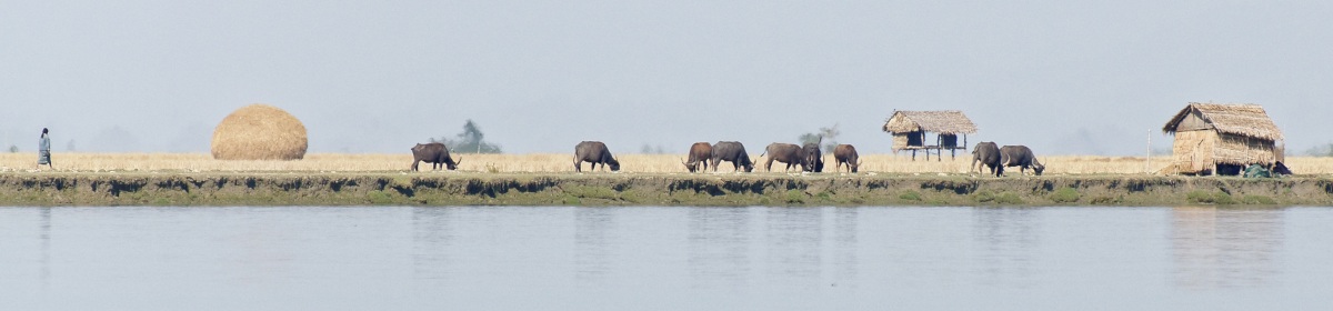
The garter snake is Massachusetts’ official state snake, and is endemic to most of North America. It’s the most common snake species, and closely related to water snakes, the genus Nerodia.
Garters communicate with and seek one another via pheromones. All garter snakes, regardless of color, have a side and a back stripe. The similarity to the garters men used to wear to hold up their socks gives the snake its name.
Barb has thoughtfully created ceramic dens for the snakes in her yard. They curl in the sun to get warm, and head for spots under rocks when it’s too hot or they feel threatened. Garters are mostly harmless, and seldom attack or strike unless cornered or threatened.
I find snakes fascinating. [2] Sacred snakes were used by the Oracle at Delphi and in ancient Minos. Recall the cobra, who spread its hood to shelter the Buddha. St. Patrick supposedly drove the snakes out of Ireland. [3] On a practical level, the garter snakes in Barb and Javier’s yard will eliminate any pest threat from rodents. (They also eat snails and slugs, common garden problems in the wet Northwest.)
As I admire the yard and go look from time to time for the two snakes I’ve seen in different parts of the garden, I think mostly about the fact that the presence of snakes means the small biosphere of my sister’s home is a healthy one. It’s not a coincidence that garter snakes are often referred to as ‘garden snakes’.
NOTES: [1] See my earlier post Meet the One-Tracks. [2] Fun science facts: some garter snake species have two-colored tongues. They are ovoviviparous, meaning they give birth to live young. Garter snakes go into something called brumation before mating. [3] Ireland didn’t have snakes….
My books are Broken In: A Novel in Stories, Tsunami Cowboys, Grounded, and The Trail Back Out. Books make great gifts!
Tsunami Cowboys was longlisted for the 2019 ScreenCraft Cinematic Book Award. Broken In: A Novel in Stories was semifinalist for the international 2020 Hawk Mountain Short Story Collection Award from Hidden River Arts and Finalist for Greece’s 2021 Eyelands Book of the Year Award (Short Stories). The Trail Back Out was American Book Fest 2020 Best Book Award Finalist: Fiction Anthologies, Runner-Up for the 2021 Top Shelf Award, 2021 IAN Book of the Year Award Short Story Collection Finalist for the Independent Author Network, and awarded a 2021 Wishing Shelf Red Ribbon. The title story The Trail Back Out was longlisted for the 2021 ScreenCraft Cinematic Short Story Award.
Click here for my author page to learn more about me and purchase my books.
Lena Kathren Headey was born on October 3, 1973 in Hamilton, Bermuda. She is, of course, the superb actress who portrayed Cersei from Game of Thrones. Cersei’s beauty and willingness to plot and then ruthlessly destroy her enemies are balanced by her deep love for her children and her inner insecurities. She is absolutely magnificent and I will never forgive the producers of the show for leaving her gazing pointlessly over the ramparts of King’s Landing for most of the final season. What a betrayal of her character’s intelligence, and what a waste of her talents!
In her honor I am reprinting the post I wrote after my visit to King’s Landing, aka Dubrovnik. – Jadi
I’d wanted to see Dubrovnik for years. It’s a UNESCO World Heritage site. Dubrovnik is one of the most intact – and surely one of the most beautiful – walled cities on the planet. It was strategically built on the Adriatic coast, has spectacular scenery, and provides settings for one of my favorite shows, Game of Thrones. It had to be perfect!
Note to Self: In the future, question any place that sounds too good to be true. It usually is.
Aw, come on. King’s Landing! Cercei’s Walk of Shame! Tyrion sightings!
This trip was going to be awesome!
I frequently meet a friend on her way back through Europe as she travels around the world. We travel well together, enjoy exploring new spots, and always have great luck with our plans. We’ve never booked a bad hotel.
Note to Self:Always and never are adjectives doomed to fail at some point.
I flew to Dubrovnik a day early and went hunting for the hotel. I dragged a suitcase up the stone stairs of narrow alleys. And down the stone stairs of narrow alleys. And then back up the stone stairs of narrow alleys. No sign over the doorway, no answer when I repeatedly knocked. Not one person who could give me any information.
It was really hot, humid and sticky, and overcrowded with tourists now heading to the outdoor restaurants for supper. I sat beside my suitcase on the hard stone steps, trying to stay calm (forget about cool or collected – at that point I was drenched in sweat). I dug out the phone number for the hotel contact.
Note to Self: Never, ever leave home without your cell phone fully charged and that list of phone numbers close at hand.
“You’re here?” a male voice exclaimed. “Someone will be there with a key in ten minutes.” I was still waiting over half an hour later. A pleasant young man finally arrived. Why hadn’t I called when I arrived at the airport to let someone know to come meet me?
Note to Self: They never suggested that we do this. Regardless, it was their guests’ fault.
He let me into the hotel… a home converted into apartments. We’d requested separate beds; the room only contained one. I didn’t mind sharing, but the hotel room furnishings were neither as advertised nor promised. The air conditioner had been installed so that it blew directly into the head of the bed.
Note to Self: Check carefully when booking rooms. Sometimes Southern and East Europeans have loose definitions for things, including accommodations and measurements of time.
What about the included breakfast? I asked. No worries, I just needed to head down the steep stairs a few streets, turn into the main road, and find the café the hotel apartment rooms had made arrangements with to feed guests.
Relieved to finally be in my hotel lodging I showered, changed clothes, and went out to find dinner. No time left for sightseeing.
The next morning, I eventually found the café after going in the wrong direction and hungrily gazing at a half-dozen other breakfast spots. “Where’s your voucher?” the waiter asked. “Uhh, I wasn’t told I needed one,” I stuttered, and retrieved the hotel booking invoice I luckily had with me. The waiter vanished with it and consulted a colleague. He returned with a different menu with fewer choices. I ate a passable breakfast and headed off to walk the city walls.
The wall is everywhere
Now, this was more like it! Not a bad view in any direction and it was early enough not to feel the oppressive heat already settling on the city. What a shame there were so many other people crowding the ramparts.
Back at the room I waited for my friend to arrive. One of the young men showed up and insisted, “No, you don’t need a voucher for breakfast, regardless of what the café says. And you should have waited and walked the city walls late in the afternoon when the cruise ships have left again.” So why didn’t he tell me this yesterday? But, I thought, it would have meant traversing the walls for two hours in 90-degree peak afternoon heat, so I didn’t speak up.
He wouldn’t let me pay with a credit card. Cash only. We’d have to wait until his associate came the next day as my friend hadn’t arrived yet. When we paid, he couldn’t make change. He promised to bring it by later; if we weren’t there, he’d put the money they owed us under the room door.
The man and the money never showed up.
The last morning, I tried to get out of bed and thought I was going to throw up. I had developed benign paroxysmal positional vertigo (BPPV) from the extreme heat, not enough fluids, and cold air blowing on my face all night.
Just before we checked out I wrote a curt note indicating where to have the money deposited that they still owed us. As we were leaving we ran into a cleaning woman. “Oh! The boys couldn’t make it over yesterday. They asked me to give it to you.” We then headed off to the airport with money we no longer had any time to use.
Note to Self: Make sure to carry lots of small bills to make change next time you go back. If you ever go back. 2nd Follow-up Note to Self: Cash-only vacation options are a really bad idea. 3rd Follow-up Note to Self: Do Not Sleep Directly Under an Air-Conditioner. Ever.
I remind myself Dubrovnik is all romantic corners and silly tourists taking selfies.
and the European Cup soccer matches!
Croatia’s flag flying proudly for the soccer tournament
I’ll tell you another time about how I almost didn’t make it on our plane going home. Or why my friend was late getting to the hotel room. She’d been charged $600 for her rental car, dinged when a gang tried to scam her with a staged accident.
I shall be forever grateful that we were there together. We even laugh about parts of the trip to Dubrovnik, and figure those few days used up more combined residual bad travel karma (and available cash) than any trip we’ve ever gone on.
Note to Self: Re-read this post before planning the next trip!
My books are Broken In: A Novel in Stories, Tsunami Cowboys, Grounded, and The Trail Back Out.
Tsunami Cowboys was longlisted for the 2019 ScreenCraft Cinematic Book Award. Broken In: A Novel in Stories was semifinalist for the international 2020 Hawk Mountain Short Story Collection Award from Hidden River Arts and Finalist for Greece’s 2021 Eyelands Book of the Year Award (Short Stories). The Trail Back Out was American Book Fest 2020 Best Book Award Finalist: Fiction Anthologies, Runner-Up for the 2021 Top Shelf Award, 2021 IAN Book of the Year Award Short Story Collection Finalist for the Independent Author Network, and awarded a 2021 Wishing Shelf Red Ribbon. The title story The Trail Back Out was longlisted for the 2021 ScreenCraft Cinematic Short Story Award.
Click here for my author page to learn more about me and purchase my books.
On August 25, 1916, President Woodrow Wilson signed the “Organic Act” creating the National Park Service, a federal bureau in the Department of the Interior responsible for maintaining national parks and monuments that were then managed by the department. The National Park System has since expanded to 423 units (often referred to as parks), more than 150 related areas, and numerous programs that assist in conserving the nation’s natural and cultural heritage for the benefit of current and future generations. – National Park System
In honor of the creation of National Park System I am reprinting the post I wrote after we visited the parks of the SW. – Jadi
We fondly refer to one trip we took as Our Vacation of the Rocks. We did a long loop of the American SW’s national parks. From the Grand Canyon we went to Zion, on to Grand Staircase/Escalante, Natural Bridges, Canyonlands National Park and Arches. We spent a few days at Mesa Verde and then headed south into New Mexico. We ended our trip back in Arizona at the Chiracahua National Monument Wilderness and the Sonoran Desert Park.
Canyonlands
We had a national park pass and drove from one incredible natural site to the next. We spent each day in our hiking boots, holding a park map. The quality of the stones we clambered over changed daily. It was all stunningly beautiful, the hard landscapes like being on the surface of the moon. (Bonus points for those of you paying careful attention: I’ll refer back to this post when I get around to writing about Hampi, India and Mount Teide, Tenerifa.) We hiked up, around and over endless variations on red striped rocks and hillocks of crumbling yellow sandstone. We picked out way down hillsides scrubby with deceptively harmless-looking small cacti.
Watch your step at the Grand Canyon!
I needed to replace my worn-out day pack. In Moab, Utah I headed into a well stocked mountain bike shop; the young salesman actually sneered when I insisted that I didn’t want a high end all weather multi purpose pack. “I just need something for day hikes,” I repeated. He lifted the inferior item with one finger and dropped it on the counter in front of me. It was perfect (and, to this day years later, I still get good use out of it).
I bought turquoise jewelry at a pawnshop in Gallup, New Mexico. We got to watch a naturalization ceremony in Sante Fe that was quite moving. Immigrants from at least 20 countries stood up when the judge called out the name of the country these new Americans hailed from.
We ate posole and regional Mexican-American dishes. In a Tucson restaurant we watched incredulous while a hot sauce seller set out samples on a table for the owner to try. One of them, he cautioned, was so hot that just one drop of the stuff would burn a hole in his tongue if he tried to taste it like a ‘normal’ hot sauce. (No, we did not try it!)***
Arizona’s Chiricahua Wilderness is like hiking through high stacks of pancaked rock. From beneath some brush a rattlesnake sounded a warning. I waited for the Swedish family I had heard talking on the trail behind us and pointed out the snake to their small boys. We met the family back up at the parking lot later, and the parents came over when they saw me. “Since we started planning this trip our boys have talked about nothing but how much they want to see a rattler! Thank you for making their vacations!” I laughed pleased (really I’d mentioned the snake both to warn the perhaps uninitiated, also to slow them down on the trail so that Uwe and I could have the section up ahead for ourselves). But I did feel I’d done a good deed.
Uwe loves the ‘otherness’ of the landscapes of the SW. I revel in the unabashed raw open nature. Rocks, stone, mountains and ravines, gorges and arches: all that geological strata. My heart resides in the leafy wooded Adirondacks, but any region with so much dedicated parkland is dear to me.
Zion National Park
What is astonishing about the Southwest is the balance of stony terrain, flora and fauna. Cities will rise and fall; we build beautifully, or dreadfully, and reap our efforts or laziness. Mother Nature took millions of years to figure out what works. Maybe we should take our cue from her.
My books are Broken In: A Novel in Stories, Tsunami Cowboys, Grounded, and The Trail Back Out.
Tsunami Cowboys was longlisted for the 2019 ScreenCraft Cinematic Book Award. Broken In: A Novel in Stories was a semifinalist for the international 2020 Hawk Mountain Short Story Collection Award from Hidden River Arts and a Finalist for Greece’s international 2021 Eyelands Book of the Year Award (Short Stories). The Trail Back Out was American Book Fest 2020 Best Book Award Finalist: Fiction Anthologies, Runner-Up for the 2021 Top Shelf Award, 2021 IAN Book of the Year Award Short Story Collection Finalist for the Independent Author Network, and 2021 Wishing Shelf Red Ribbon Band. The title story The Trail Back Out was longlisted for the 2021 ScreenCraft Cinematic Short Story Award.
Click here for my author page to learn more about me and purchase my books.
Baron Haussmann was born on March 27, 1809 in Paris, France. Napoleon III selected him to build new parks, boulevards and buildings for the city. Haussmann was forced out for extravagance (!), but his planning created the City of Lights we all love. In his honor I am reprinting the post I wrote after we visited Xi’an, China. – Jadi
This is a real road in Xi’an
This week’s post is about one of the more remarkable roads I’ve ever strolled. The street is in Xi’an, home of one of the world’s best preserved, still-intact, walled cities. We’re big fans of places listed on the UNESCO World Heritage Site, and Xi’an is on Chinese and international lists as a cultural treasure.
This however is not a city street. This ‘boulevard’ is actually on top of Xi’an’s city wallsFrom atop the wall with a bird’s eye view
It’s an old capital city located at the end of the Silk Road. The rampart walls were built in the 14th century by Emperor Zhu Yuanzhang as part of his military defenses and enclose 8.7 square miles, or roughly 14 square kilometers. [1]
The walls were made first with tamped earth and ‘with the base layer including also lime and glutinous rice extract’. [2] A century later they were reinforced with blue bricks. The original walls used to include a moat and drawbridges. These walls are so thick that in WWII, Xi’an’s residents built a thousand bunkers inside the base to protect them from the bombs of Japanese air raids!
They are a breathtaking 12 meters or 39 feet high. It takes four hours to walk them. Actually, it takes longer than that if you’re Uwe and Jadi, because you never know what’s down the road. On our visit (foolishly booked during China’s Golden Week when all 1.3 billion Chinese citizens were also on vacation) we discovered a festival performance taking place inside one of the courtyards.
We heard it before we saw it. Drums, lots of drums…
And men in costume. Enter, Stage Left.
Or was that Enter, Stage Right?
What tickles me most about the walls is that once you’re on them, you could be on a wide boulevard anywhere in the world. Except that this is China, and this isn’t a boulevard…. It’s a wide street located on top of Xi’an’s city walls. Travel doesn’t get any better than this.
In memory of Baron Haussmann, 27 March 1809 – 11 January 1891
My books are Broken In: A Novel in Stories, Tsunami Cowboys, Grounded, and The Trail Back Out.
Tsunami Cowboys was longlisted for the 2019 ScreenCraft Cinematic Book Award. The Trail Back Out was honored as 2021 IAN Book of the Year Award Short Story Collection Finalist for the Independent Author Network, and American Book Fest 2020 Best Book Award Finalist: Fiction Anthologies. The title story The Trail Back Out was longlisted for the 2021 ScreenCraft Cinematic Short Story Award. Broken In: A Novel in Stories was a semifinalist for the international 2020 Hawk Mountain Short Story Collection Award from Hidden River Arts, and named a Finalist for Greece’s international 2021 Eyelands Book of the Year Award (Short Stories).
Click here for my author page to learn more about me and purchase my books.
Artist Paul Klee was born on December 18, 1879 in Münchenbuchsee, Switzerland. He was a part of the Bauhaus movement and wrote about color theory. Klee traveled to Tunis in April of 1914 for twelve days. The colors and light of North Africa strongly influenced his paintings and those of his companions August Macke and Louis Moilliet. In his honor I am reprinting the post I wrote after we visited Tunisia. – Jadi
We flew down to Tunisia for a week in September that year. I’d planned to write about Hammamet’s lovely laid back tourist vibe, the gorgeous beaches and how much fun it was viewing the Mediterranean from the Africa coast for the first time.
I didn’t want to obsess on the fact that a few weeks later terrorists shot tourists in a museum down the road from the souk we visited. I definitely don’t want to think about the beach where tourists from around the world were murdered in cold blood that summer. It’s less than 30 kilometers (20 miles) from the hotel we stayed in.
Those cowardly acts have nothing to do with what Uwe and I experienced. I took notes as I sat on our sweet balcony, and here is what I wrote:
“The tourists are international. Every body size and shape, every age is represented. We see groups of Italians, French, Egyptians, Algerians, Germans and Brits. Women in black leggings, head scarves, and long sleeved tunics sit by the pool. Two men (young Arab males) hold hands and spring into the pool at a running jump. Kids run and play everywhere I look. Old folks in wheel chairs are pushed by family members.
The French and Italian tourists live up to their reputations with their rule of remaining poolside until 6 p.m. Then they go to change for dinner at 7:00.
View from our balcony. Taken early evening, when guests had headed to their rooms to change their clothes and think about dinner
Lots of Middle East tourists are traditionally dressed in modest clothing. [1] They swim in the ocean fully dressed! But there are also single Arab women in bikinis, or young couples on holiday.”
I sat and revised Tsunami Cowboys under one of these umbrellas…
“Paragliders are pulled by boats, a yacht and sailboat or two glide by, an endless panorama of ocean spreads from left to right. Without talking about it we head past the pool to go down to the lounge chairs under sun umbrellas on the beach. Uwe reads and I edit the manuscript for my second book Tsunami Cowboys. I’m beyond happy: I’m in an exotic locale with fun stuff to notice all around me and I’m doing good writing work. Each afternoon around 4 I stop and swim in the ocean.”
Our hotel was about twenty minutes from the center of Hammamet. Sometimes we strolled into town for dinner; some nights we had a drink at the hotel and picked one of the restaurants there. We did a couple of tours, to Tunis, Sidi Bou Saïd
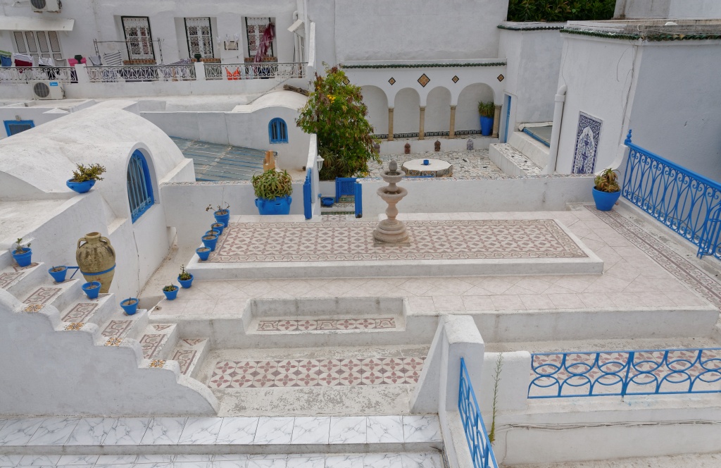
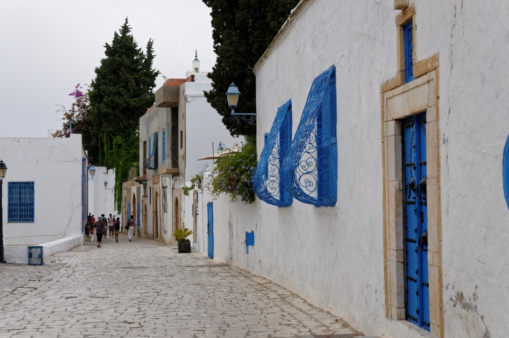
Sidi Bou Saïd is justifiably famous for its vivid blue architecture
Sidi Bou Saïd is popular with artists too
and the ancient city of Carthage. [2]
I bargained for sandals at Tunis’ souk [3],
and harissa and couscous spices at an outdoor market.
Touristy? Sure. But here are more of my notes from that week: “Everyone smiles and says hello in the hotel. We’re all here to relax and co-mingle. I have the lovely experience of being welcomed as an American – and when was the last time that’s happened lately – the locals intrigued to learn where I’m from, and even more intrigued to hear that I live in Europe.
I think that’s partly because not many Americans make it to the area, or maybe our hotel books more Europeans and Arabs. Certainly on our charter flight from Germany I’m the only Ami on board! Tunisians are delighted when I assure them that yes, I am enjoying my first visit to their country.”
We learn that Tunisia’s population of 8 million swelled by an additional 2 million people displaced by wars. Tunisia is a struggling democracy in an unstable part of the world. The Tunisians on the coast are hospitable, curious, worldly. And I want to go back.
I want Tunisia without terrorism.
In memory of Paul Klee, 18 December 1879 – 29 June 1940
My books are Broken In: A Novel in Stories, Tsunami Cowboys, Grounded, and The Trail Back Out. Books make great gifts!
Tsunami Cowboys was longlisted for the 2019 ScreenCraft Cinematic Book Award. The Trail Back Out was honored as 2021 IAN Book of the Year Award Short Story Collection Finalist for the Independent Author Network. In addition, The Trail Back Out was an American Book Fest 2020 Best Book Award Finalist: Fiction Anthologies. The title story The Trail Back Out was longlisted for the 2021 ScreenCraft Cinematic Short Story Award. Broken In: A Novel in Stories was a semifinalist for the international 2020 Hawk Mountain Short Story Collection Award from Hidden River Arts, and is now a Finalist for Greece’s international 2021 Eyelands Book of the Year Award (Short Stories).
Click here for my author page to learn more about me and purchase my books.
To mark the 76th anniversary of the dropping of the atomic bomb on Hiroshima, Japan, I am reprinting my post 8:15 A.M. This tragedy must never be repeated. – Jadi
At 8:15 a.m. some 65 years later,
Birds perch on the Dome.
It’s startlingly calm. A becalming place
Green, tranquil, filled with standing statues
tourists with cameras and
prayers for peace and
pray-ers for peace and
Classes of school children
running
water everywhere.
They bring chains of 1,000 cranes
folded in loving memory of Sadako Sasaki
Her cranes became tinier
leukemia advancing until
Sadako folded symbols of longevity and healing
with the aid of a pin.
At 8:15 a.m. some 76 years later,
Five cranes hold sentinel on
ruined
blackened
girders
The skeleton now, simply,
called the A-Bomb Dome.
Statues are the world’s countries’ monuments
to Hiroshima reborn, arisen
declaring her residents will,
forever, live
in a place called The City of Peace.
Classes of children, schooled in knowledge of what
unthinkable tragedy
took
place
here
stand for photos before the fountain with the flame
in the center burning
until the last nuclear weapon is dismantled;
Before the cenotaph shielding
names of the dead, reopened, names
added on August 6th.
The Peace Park, the terrible
hypocenter.
And the tourists with cameras?
We bear witness. We come to
ask, Why?
How many
angels danced on the head of a pin?
We come to see The Truth or
as much truth as we can bear.
Seeing demands the clearest sight
possible when your eyes are filled
with the pin pricks of tears
Water,
like the water the burned begged for as they died
The peace fountains spouting outside the museum
the river that flows
calmly, becalmingly
near the A-Bomb Dome,
where the cranes have taken up residence.
(17 October 2010 21:27 p.m. Updated 6 August 2021.)
The cenotaph is opened each August 6th and the newest names of the dead are added. Its arched form provides a shelter to the souls of the victims.
The Peace Park contains statues dedicated by countries around the world; a museum; and monuments. We visited at night and the Dome (the only building left standing after the blast) was occupied by cranes. The image of this World Heritage Monument and the symbolic birds took a powerful hold on my imagination. When we returned at daylight to visit the park it overflowed with classes of laughing children, stunned tourists, and an atmosphere that is impossible to describe. It is a place of shared tragedy, and humanity.
The cranes were still there, perching in the Dome.
My books are Broken In: A Novel in Stories, Tsunami Cowboys, Grounded, and The Trail Back Out.
Tsunami Cowboys was longlisted for the 2019 ScreenCraft Cinematic Book Award. The Trail Back Out was a 2020 Best Book Award Finalist for Fiction Anthologies. The title story The Trail Back Out was longlisted for the 2021 ScreenCraft Cinematic Short Story Award. Broken In: A Novel in Stories was named a semifinalist for the 2020 Hawk Mountain Short Story Collection Prize.
Click here for my author page to learn more about me and purchase my books.
My husband used to work in northern Sweden every winter. (Go to It Was a Bitterly Cold -22 Degrees) I flew up for a long weekend. On Friday he had to drive on a frozen lake, writing code for the braking system that would become ESP, a safety feature now installed in cars everywhere.
I went exploring in downtown Arjeplog. The only tourists were people like me, family members visiting the car engineers.
It was March, a grand -6 degrees at the warmest part of the day, so I went to the Silvermuseet. I like museums anyway, and Arjeplog’s museum is a fun mix of artifacts from early settlers, a history of the now-closed silver mines, and the earliest presence of humans. I was the only visitor in the museum.
A tall glass case contained a runebomme, an old Saami drum. [1] When I moved closer for a look, lights clicked on and a recording of drumming began to play. I was surprisingly moved, and totally intrigued by the images etched on the drum hide. Animals, people, and boats were depicted.
The Saami Shaman Drum Kobdas (drum) is a sacred map. It contains drawings of people and the spirit gods and goddesses of Nature often centered around a symbol of the sun. They are used by the shaman (male and female alike) to awaken other levels of reality to guide families in their daily life, find the right path during migrations, locate things which are missing, heal diseases and help the community in times of crisis. They can also foresee the future and give guidance. [2]
The museum gift shop sold gifts made by local artists. I bought myself a necklace. It’s made with reindeer horn scrimshaw, embedded in arctic curly birch. I don’t wear it often, but when I do it always feels special.
Many years later I wrote a character named Gabe Burgess, who is given a similar necklace by his Norwegian lover as a remembrance before they part ways in Greece. I liked the idea of a burly man tucking the amulet into his shirt when he went traveling.
Eight-pointed snowflake
I thought my necklace was the image of a snowflake. Today, as I did some research to make sure this post’s information on the museum and the drums is accurate, I discovered this:
The image is really an early compass.
My world explorer Gabe has always worn a depiction of the points of the compass, guiding him safely home.
Perfect. – Jadi
Saami compass
He liked the romance of travel, in every sense of the word. His destinations veered wildly from year to year. In the beginning, Gabe’s journeys were random. As a youth Gabe traveled with a heavy, framed backpack and headed often for the beaches. He spent a blissful month camping on the southern coast of Crete with a busty blonde from Norway named Berit. At the end of the four weeks he returned to New York City with Berit’s address and telephone number tucked inside his passport, and a talisman around his neck. On their last night together she had turned her head away from him and reached for the necklace tucked under her long hair.
She made him close his eyes as she placed a chain over his neck. “Go look in the mirror,” she requested, and obediently Gabe walked to the little oval mirror in their beach hostel. In it he found his own image (now much darker and even properly black after a month spent in the island sunshine), his neck encircled with an image on wood. He pulled the chain back over his head to examine it more closely.
Signed by the artist
Berit put her arms around his waist and stared over his shoulder at him in the mirror. “It’s Saami.” She explained, “It’s a snowflake with eight points to it, carved on reindeer horn. The wooden back is birch. It is to bring you luck, dear friend,” she added solemnly, and kissed the side of his temple.
-from my chapter Waiting in Broken In: A Novel in Stories
Broken In: A Novel in Stories was a semifinalist for the international Hawk Mountain Short Story Collection Award from Hidden River Arts. Click here for my author page to learn more about me and purchase my books.
I’m sitting down to drink a cup of tea. If you don’t hear from me again, please notify my husband.
I’m going to try dittany or diktamos. The Cretans call it erontas or erondas, from the word eros. As you know, Eros is the Greek god of love and sexuality. The Greek is diktamos (δίκταμος) or erondas (έρωντας).
Diktamos is an herb that grows only on remote, rocky hilltops on the island of Crete. The name comes from the Dikti mountain range in the Lasithi region of East Crete.
The use of dittany goes back into the mists of history. It may be the plant featured in the fresco of garlands at the Minoan palace of Knossos. Hippocrates prescribed it. Homer, Euripides, Aristotle and Theophrastus, Plutarch and Virgil all wrote about the herb.
When Aeneas is injured, his mother Aphrodite (Venus) uses dittany to cure him:
A branch of healing dittany she brought
Which in the Cretan fields with care she sought:
Rough is the stern, which woolly leafs surround;
The leafs with flow’rs, the flow’rs with purple crown’d,
Well known to wounded goats; a sure relief
To draw the pointed steel, and ease the grief. [1]
Even characters in Baudelaire’s Les Fleurs du Mal and JK Rowling’s Harry Potter and the Deathly Hallows use dittany. The herb is considered an aphrodisiac (okay, maybe not in Harry Potter). Suitors collected the wild dittany flowers and gave bouquets to prove their love. The young men were known as “erondades (love seekers) and were considered very passionate men to go to such dangerous lengths to collect the herb.” [2] Traditionally, diktamos was given to newlyweds to inflame desire.
It can be used both internally and externally: a poultice, an essential oil, for application on wounds, an herbal tea (my chosen method – I bought a bag of dried herbs when we were on Crete this fall), to disinfect wounds, chewed, or as toothpaste for a sore throat and to clean the mouth and teeth. Dittany is distilled and used as a bitter in vermouth or martinis (for example), and in cosmetics. [3]
Finally, before I drink my brewed cup, I give you my favorite fact. Dittany/Diktamos is also known as the burning bush. I leave it to you to decide why I’m drinking it.
Click here for my author page to learn more about me and purchase my books.
“Dittany contains an essential oil called Carvacrol, which is a natural antibiotic, 50 times stronger than penicillin. In the leaves, there is furthermore a substance called Dictamin, which is used for cardiovascular diseases. In all, there are 70 different curative substances in the plant that can be extracted and used for medication or cosmetics.” — ilovecrete.eu
“Compounds of Dittany are powerful antioxidants. The essential oils have also antiseptic and anti-fungal properties and are often used in ointments to treat burns and skin ailments. Tea made from dittany is used to relieve tension headaches and as a relaxant. Dittany is also used to relieve indigestion, colic, stomach cramps and bloating. It is also thought to be a diuretic and to combat fever.” —greece-is.com
We spent a couple weeks in Malaysia this spring. Most of that time we stayed in the classic tourist destinations: Georgetown and Melaka for their rich layers of Dutch, Portuguese, British history.
Visitors at St. Paul’s Church, MelakaPortuguese tombstones, St. Paul’s Church, Melaka
We tried to see some of the incredible nature, too. My personal highlight was Sarawak on Borneo. We went to the UNESCO global geopark on Langkawi Island and took a bus inland to the tea country of the Cameron Highlands.
Everywhere we went, I was struck by two things. The first is that in a predominantly Muslim country it can take a while to find alcohol. Evening mealtimes for Uwe and me are when we want to linger over a glass and talk about what we saw during the day. In Malaysia we’d peruse the menu at the front of a restaurant and turn the pages to the very back where the drinks were listed. If it didn’t serve beer or wine, often we’d smile and say thank you, and head further down the street feeling slightly like jerks.
Mosque and Muslim cemetary, Sarawak, Borneo
The second thing I noticed is that in every place we visited, streets in Malaysia contain the houses of worship of different religions. Muslim mosques, Christian churches, Hindu, Buddhist, Tin Hau and Chinese temples, one next to the other line a street. Everywhere.
Hindu temple, GeorgetownHindu priest, GeorgetownThe goddess Tin Hau, patroness and protector of sailors and immigrants, Georgetown
We explored many of them and I was delighted and calmed by the sweet atmosphere in these roads. The world feels more and more divided. But the Malaysians we talked with are proud of the religious tolerance and multicultural blend that makes up their country.
Chinese temple lanterns, Sarawak, BorneoDutch, British, German cemetary, Melaka
And that’s a concept I’ll gladly raise a glass of wine to….
This week’s post is about one of the more remarkable roads I’ve ever strolled. The street is in Xi’an, home of one of the world’s best preserved, still-intact, walled cities. We’re big fans of places listed on the UNESCO World Heritage Site, and Xi’an is on Chinese and international lists as a cultural treasure.
This however is not a city street. This ‘boulevard’ is actually on top of Xi’an’s city wallsFrom atop the wall with a bird’s eye view
It’s an old capital city located at the end of the Silk Road. The rampart walls were built in the 14th century by Emperor Zhu Yuanzhang as part of his military defenses and enclose 8.7 square miles, or roughly 14 square kilometers. [1]
The walls were made first with tamped earth (and, according to Travel China Guide, ‘with the base layer including also lime and glutinous rice extract’). [2] A century later they were reinforced with blue bricks. The original walls used to include a moat and drawbridges. These walls are so thick that in WWII, Xi’an’s residents built a thousand bunkers inside the base to protect them from the bombs of Japanese air raids!
They are a breathtaking 12 meters or 39 feet high. It takes four hours to walk them. Actually, it takes longer than that if you’re Uwe and Jadi, because you never know what’s down the road. On our visit (foolishly booked during China’s Golden Week when all 1.3 billion Chinese citizens were also on vacation) we discovered a festival performance taking place inside one of the courtyards.
We heard it before we saw it. Drums, lots of drums…
And men in costume. Enter, Stage Left.
Or was that Enter, Stage Right?
What tickles me most about the walls is that once you’re on them, you could be on a wide boulevard anywhere in the world. Except that this is China, and this isn’t a boulevard…. It’s a wide street located on top of Xi’an’s city walls. Travel doesn’t get any better than this.


 The garter snake is Massachusetts’ official state snake, and is endemic to most of North America. It’s the most common snake species, and closely related to water snakes, the genus Nerodia.
 I find snakes fascinating. [2] Sacred snakes were used by the Oracle at Delphi and in ancient Minos. Recall the cobra, who spread its hood to shelter the Buddha. St. Patrick supposedly drove the snakes out of Ireland. [3] On a practical level, the garter snakes in Barb and Javier’s yard will eliminate any pest threat from rodents. (They also eat snails and slugs, common garden problems in the wet Northwest.)
 As I admire the yard and go look from time to time for the two snakes I’ve seen in different parts of the garden, I think mostly about the fact that the presence of snakes means the small biosphere of my sister’s home is a healthy one. It’s not a coincidence that garter snakes are often referred to as ‘garden snakes’.


 Aw, come on. King’s Landing! Cercei’s Walk of Shame! Tyrion sightings!


 I remind myself Dubrovnik is all romantic corners and silly tourists taking selfies.
 and the European Cup soccer matches!


 We heard it before we saw it. Drums, lots of drums…

 What tickles me most about the walls is that once you’re on them, you could be on a wide boulevard anywhere in the world. Except that this is China, and this isn’t a boulevard…. It’s a wide street located on top of Xi’an’s city walls. Travel doesn’t get any better than this.


 We tried to see some of the incredible nature, too. My personal highlight was Sarawak on Borneo. We went to the UNESCO global geopark on Langkawi Island and took a bus inland to the tea country of the Cameron Highlands.


 We explored many of them and I was delighted and calmed by the sweet atmosphere in these roads. The world feels more and more divided. But the Malaysians we talked with are proud of the religious tolerance and multicultural blend that makes up their country.


 And that’s a concept I’ll gladly raise a glass of wine to….
 NOTES: © Jadi Campbell 2019. All photos © Uwe Hartmann. To see more of Uwe’s pics from Malaysia and our trips go to
  We heard it before we saw it. Drums, lots of drums…

 What tickles me most about the walls is that once you’re on them, you could be on a wide boulevard anywhere in the world. Except that this is China, and this isn’t a boulevard…. It’s a wide street located on top of Xi’an’s city walls. Travel doesn’t get any better than this.